


About Us
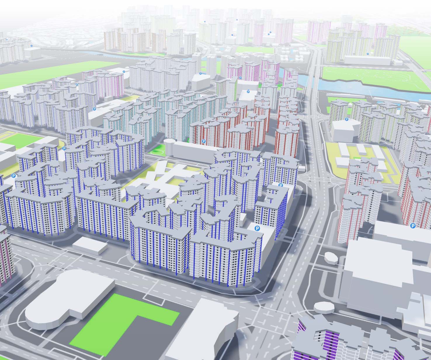
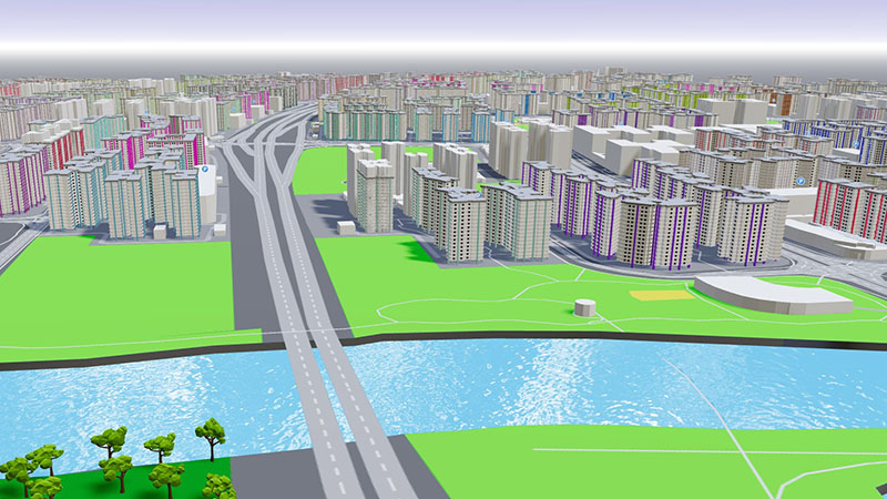
Despite frequent encounters with realistic 3D cities in AAA games, the dynamic visualization of large-scale 3D cities via browsers remains in the initial phases of development.
Amidst the Singapore government's persistent efforts to establish Singapore as a smart nation, we at Yilumi Studio anticipate a significant surge in demand for city digital twin related projects in the upcoming years.
Drawing on the 2 founders' diverse expertise in 3D graphics, game development, and web technology, we started developing LANDBOX — a prototype platform designed to support city digital twin related projects. Initially concentrating on Singapore, this focus enables us to rapidly develop and enhance features and functionalities.
LANDBOX offers the following benefits:
- Fast, reliable, and scalable
- Supports rich user interactions
- Works in any browser, mobile or desktop
- Features and functions specific for Singapore
- Ability to integrate with real-time data
Services
Leveraging our unique cross-industry experience in visual effects, 3D graphics, game development, and web technology, we offer a range of services for our prospective clients. These include private companies, educational institutions, and government agencies.
Prototyping
For clients interested in demonstrating POC for new ideas that leverage React and web-based 3D graphics, we can rapidly develop prototyping projects.
Projects
If your new project requirements closely align with our demo projects, we are open to collaboration or taking on your projects.
Consultation
For your existing projects that require web-based 3D graphics, we provide solutions for optimization, visual quality enhancement, and user experiences.
Training
Training sessions/workshops for web developers interested in bridging the gap between web technology and 3D graphics.
Get a Quote
If you would like to use our services, please get in touch to schedule an appointment. This will allow us to give you a customized quote tailored to your needs.
Frequently Asked Questions
- What sets your project apart from existing 3D maps?
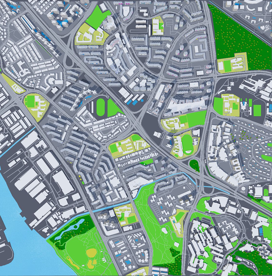
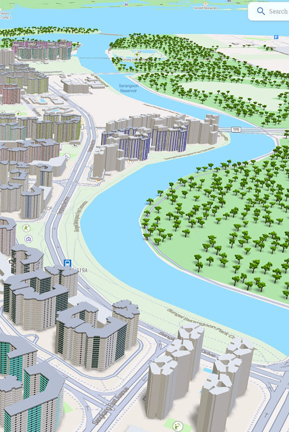
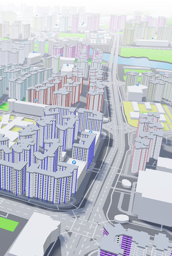
Typically, 3D models in maps are either fully generated from vector data (e.g., Mapbox) or streamed on demand as pre-generated 3D assets (e.g., Cesium.js). Our system employs a hybrid of these approaches, allowing for enhanced visual details in specific buildings while ensuring fast rendering speeds for other assets.
- What proprietary technologies have been developed for this project?
A rendering pipeline optimized with features from game engines to enhance rendering speed by reducing GPU draw calls. As our project does not use a game engine, we must develop this pipeline from scratch.
Proprietary 3D model compression method, specifically designed to handle a large number of buildings, crucial for efficient streaming of model assets over the internet. - How do we obtain and process geospatial data?
The first step involves importing geospatial data from the OSM database. This data is then processed by automated scripts for error detection and correction, and enhanced with custom data from government-maintained public sources. Finally, the processed data is saved into our database and converted into vector data.
- How do we generate the 3D models?
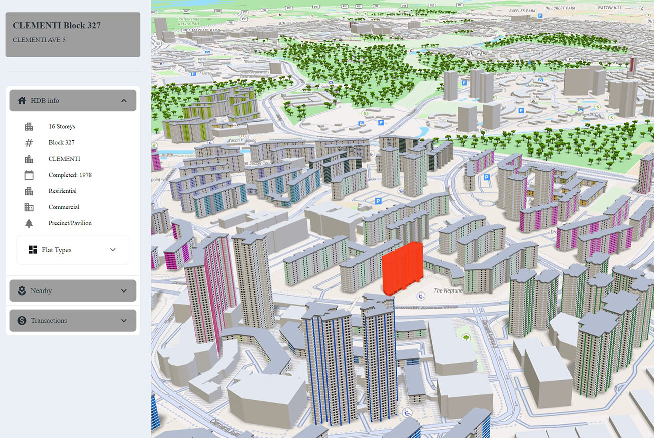
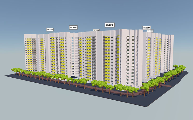
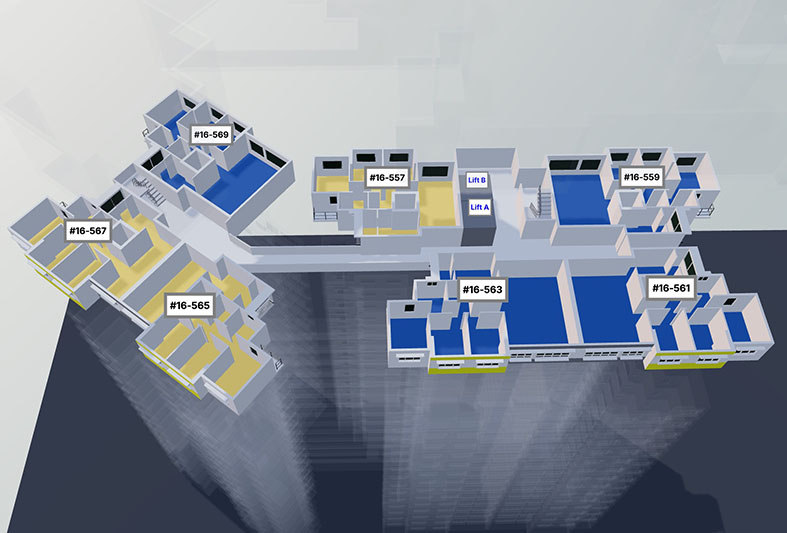
3D models of water, land areas, roads, and some buildings are created on-demand on the client's side using three.js. More visually detailed buildings, currently limited to HDBs, are generated offline through procedural modeling techniques from game development.
- What are the future milestones for this project?
1. Integrate real-time data into our system:
Integrate real-time data feeds, like traffic information, into our system using APIs from traffic data providers to display current conditions. Additionally, incorporating live event data might require partnerships with event organizers or social media platforms for timely updates in specific locations.2. Build an automated process to update geospatial data:
Set up automated workflows to regularly fetch and integrate updated geospatial data into our database. This can involve using scheduled tasks to pull data from various sources like government databases, satellite imagery, and urban development records.3. Use AI to generate more accurate 3D models:
Leveraging AI by using machine learning techniques to process images and data to create or refine 3D models of environments.


Team
The LANDBOX project started since Sep 2023 with 2 developers:

Mei Gangwen
WorkYilumi Studio - Founder (2021 to Present)
Bandai Namco - Senior Tech Artist (2016 to 2021)
Double Negative - VFX Artist (2014-2015)
Lucasfilm Animation - VFX Artist (2009-2014)
Bank of America - Business Analyst (2008-2009)
Education
Bachelor of Electrical Engineering NUS (2004-2008)
Raffles Junior College (2002-2003)
Raffles Institution (2000-2002)

Cai Weiyu
WorkYilumi Studio - Founder (2020 to Present)
Bandai Namco - Senior Software Engineer (2016 to 2020)
Autodesk - Software Engineer (2013-2016)
Lucasfilm Animation - Software Engineer (2010-2013)
Education
Master of Computer Science NTU (2009-2011)
Bachelor of Bioengineering NTU (2003-2007)
Contact
For general questions, please feel free to reach out to us via email. Typically, we respond within 2-3 business days.
Email:
yilumistudio@gmail.com
WhatsApp:
+65 92315056
+65 91464792